Celts, Romans and more
" The city of the Cassii was somewhat in the shape of an irregular triangle, and commenced at the southern point at Stanhill, in the Parish of DARTFORD, and extended directly north westward to Stankey"
( STANKEY was the name for an area occupying the land situated at the junction of DARTFORD Road and Baldwyns Park, and is referred to as such in the Ordnance Survey Map of 1869. ) The most common building material at that time would have been what is now referred to as 'Bio degradable' i.e. wood, mud, wattle, straw etc. As a result, there is nothing obvious to indicate its' original site and existence. The common Celtic house was round with a huge conical roof. The floor might have been of neat clay, the roof made of wood covered in thatch. The short walls would have been of wattle. The Celts were believers in settling in wooded areas , fencing off the outside and then erecting their houses and animal pens within. The Greek geographer STRABO referring to these 'Towns' (or 'Oppida' as Caesar named them) described them thus:
" Forest thickets are their 'cities'. They fence round a wide clearing with felled trees and here they make themselves huts and keep their cattle "
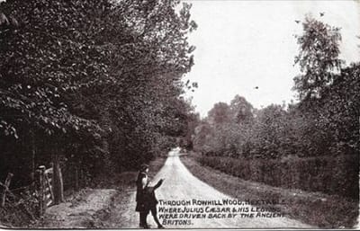
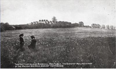
Julius Caesar led his second invasion to Britain in 54 BC and, in this area, (according to local historian DUNKIN) made an advance as far as RUE HILL (ROWHILL).
" Rue Hill is evidently a corruption of the Celtic word ' Tyrru' "
This hill still stands high and proud along Rowhill Road - just to the east of Birchwood Road between Hook Green Lane and Puddledock Lane. Legend has it that it is thanks to CASWALLEN that this was the highest point in the area - for it is purported that this natural mound was enlarged and heightened by his people. (The Ordnance Survey map of 1883 confirms a British Camp existed at this location). This then, by some form of weak definition was a Hill Fort. Legend also has it that CAESAR attacked and defeated CASWALLEN (or part of his tribe) and made his own camp at ROWHILL. CASWALLEN regrouped and within a day or so counter attacked and successfully drove off the Romans. This may be another way of saying the Romans decided they had had eoughof Wilmington and decided to march somewhere else !
The below describes an ancient British Road that still runs through Joydens Wood and which is still in evidence today. It describes at least two fortresses of this city of CASWALLEN, namely TYRRU and STANKEY. One could not be blamed for assuming that there was also another fortress at its' most southerly corner, forming a triangle of defence, at STANHILL. DUNKIN describes thus:
" The great road continued over hill and dale to the city of Cassii, which it entered at the south eastern extremity ( Stanhill ) : and by Caudens Wood ( Joydens Wood ? ) proceeded to North Cray, Prior to its' entrance it threw off two branches, one to the chief fortress, Tyrru and another to Stankey, the extreme northern point of the city "
Mike Still writes -
Cassivellaunus’ stronghold was approached after the Romans had crossed the Thames and these days it is more often associated with sites at Wheathampstead or Hexton, both in Hertfordshire, although its precise location is still unknown.
The Cassivellaunus episode is from the second of Julius Caesar’s two punitive expeditions of 55 and 54BC whereas the real Roman conquest by Claudius was in AD43. The only known local action at that time was the forced crossing of the Medway apparently followed by the attack on Colchester. This is assuming that you accept the usual story that they landed at Richborough whereas some people now say that they might have landed in a friendly area near Chichester and then advanced through Sussex before reaching Colchester! For Kent-wide information on the adaptation of the locals following the conquest there is ‘The Cantiaci’ by Alec Detsicas. For local Iron Age archaeology you could look at Dartford District Archaeological Group’s ‘Under Your Feet’.
The road named Baldwyns Park, and now on the site of Stankey Wood, was built c1927. I am told that just prior to this development this 'road' was a single track leading towards the thatched, six sided cottage in Tile Kiln Lane. ( A previous name for Tile Kiln Lane was Pot Kiln Lane
Further reading on the specific area of Leyton Cross can be found here https://www.wikizero.com/en/Leyton_Cross.
