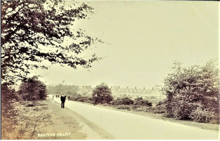
Dartford Heath and Leyton Cross
There wasn't originally going to be a page on the heath - but it featured so much in the history of the Maypole Estate that we shall begin one . . . .
Leyton Cross is temporarily hyperlinked further down the page.
The below is courtesy of Wikipedia - extracted 7/10/2018
"Prehistoric barrows, and Stone Age and Bronze Age artefacts have been discovered on Dartford Heath in some abundance.[2][3]
The heath has been important to local people since medieval times as common land;[1] it therefore escaped enclosure during the late 18th and early 19th centuries, however during this period the heath was owned by the Tredegars and it was heavily excavated for granite, chalk and other natural resources. Many pits and holes were observed in the 1830s, some "[15 or 20] fathoms deep. At the mouth and thence downward they were narrow, like the tunnel of a chimney or the passage of a well, but at the bottom enlarged; and some had several rooms or partitions, strongly vaulted and supported with pillars of chalk".[4]

Sir Charles Morgan Robinson Morgan (1792–1875), 1st Baron Tredegar, owner of Dartford Heath
They were believed to have originally been dug for the removal of chalk, which was used in building, and in fertilising agricultural land. In his History and Antiquities of Dartford, John Dunkin quoted historian Edward Hasted, “on the authority of Tacitus”, that it was “most probable that some of them were used as secret hiding places by our Saxon ancestors, for their wives, children, and goods, in times of civil war or foreign invasion”. He added that (by 1844) “most of [the holes] are now stopped up, and thus accidents which heretofore occurred both to man and beast, are prevented”.
Dunkin noted that the 1st Baron Tredegar, the lord of the manor and owner of the heath, had restricted the public’s right of way, though his tenants were allowed to graze cattle there. In 1832 a special Court Baron was held to temporarily grant to the church wardens of Dartford, in trust, some acres of common waste land on the heath for the employment (by himself) of local poor persons, and to affirm that for, much of the remainder of the heath, the public should be given right of common. However, extensive granite, chalk and turf extractions continued until the Law of Property Act 1925 severely restricted the right of lords of the manor to deface common lands as they saw fit; at which time Courtenay Morgan, 1st Viscount Tredegar, sold the heath to Dartford Urban District Council and much of the excavation works in the area ceased.
Large dips and mounds are still visible as a result of this work[5] and its associated industries. In the 19th century, towards the north of the heath, a series of parallel mounds known as the Glory Bumps were left after the extraction of clay for use in brickworks.[6]
The first recorded local cricket match took place at Bowman's Lodge in 1723;[7] and the Society of Royal Kentish Bowman, whose members included the future King George IV, met here between 1785 and 1802.[8] The nearby area is still known as Bowmans.
Soldiers were stationed on Dartford Heath in 1779-80,[9] and again during World War Two when a Royal Artillery anti-aircraft regiment was stationed there - the camp's tarmac roads are still in evidence.[10][11]
The heath today[edit]

Footpath leading from Old Bexley Lane into a south-western corner of the heath.
Since 1925 the heath has largely maintained its shape and character, except for the areas destroyed by the building of the first Dartford bypass (Princes Road), circa 1930, and the A2 dual carriageway in 1973, which cut off Leyton Cross and the southernmost parts of the heath from the north.
The heath contains three ponds (Donkey Pond, Woodland Pond and North Pond), though they have occasionally dried up in recent years, and a variety of habitats: including acid grassland, broadleaved semi-natural woodland (including oak, birch, hawthorn), heather and gorse, as well as open grassland.[12] Dartford Heath is used as a local recreation area, particularly for cyclists and dog walkers, but can be adversely affected by proximity to the local refuse and recycling centre on Old Rochester Way, which sometimes leaves windblown rubbish along nearby roads.
Management is required to maintain the heath's traditional horticulture. Efforts are centred around reduction of scrub encroachment, fire prevention, and trials to re-instate heath vegetation. The site is in a Countryside Commission stewardship scheme.[13]
While skateboarding and other pastimes have long been banned,[14] the heath was for some 80 years a designated model aircraft flying area. However permission was revoked in 2003 after a teenager died from head injuries when she was accidentally struck by a plane."[15][16]"
-------------------------
Info about Leyton Cross and the anti aircraft site from Wikipedia
--------------------------
Below - a view of the heath looking towards the Bexley Asylum c 1910. Note the trees on the right. This is the site of where houses were built along an unmade road called 'The Dell'. The child sitting in the centre of the image is probably just to the left of where Denton Road ran and is now in the middle of the new A2 - well, built in 1970 ! - and probably in the centre of the footbridge now over the A2
"Bexley Asylum" from Dartford Heath Postcard - picture Tony Kinson courtesy of the Bexley Hospital website
Nurses home not in foreground of tower - therefore pre 1928.

Below - similar shot from the driveway to Maypole House c1930 - nurses home below tower built c1928.
Photo courtesy Brian Porter

Below - Denton Terrace in background - courtesy Brian Porter
Below - Brick Hill Wood, Dartford Heath - location now known to be just North of the Dartford Golf Course and South of Heathclose Road.
Courtesy of Brian Porter![[Untitled]](https://static.s123-cdn-static-c.com/uploads/1523176/2000_5bae43393501d.jpg "[Untitled]") Below - Heathside, Dartford Heath courtesy of the late Brian Porter. The building to the left is Gravel Pit Cottage(s)
Below - Heathside, Dartford Heath courtesy of the late Brian Porter. The building to the left is Gravel Pit Cottage(s)
DARTFORD HEATH - A CHRONOLOGY
(Most of the initial information supplied on fact sheet from Dartford Library)
1660 On May 29th an address was given by King Charles II in a ceremony held on Dartford Heath. After this event had taken place several regiments of horse, under the leadership of General MONCK , escorted the King to London (DUNKIN p.386).
1723 Dartford played a cricket match against Tonbridge on the heath.
1726 Newspaper article relating to a dispute over a cricket match on the Heath between 'Chinkford' (Chingford?) and Dartford in the year of 1724. Kindly supplied by Perran Newman from publication Highways and Byeways in Kent by Jerrold (1907)

1780 The Army Camp - referred to in the Napoleonic Army Cmp.
1782 Charles SEYMOUR'S Topographical Survey of Kent reveals that Dartford was noted for its great cricket matches
1787 Royal Society of Kentish Bowmen moves from North Cray to Bowmans Lodge on the north side of the heath - later referred to.
c.1797 Reported that the heath comprised approx. 500 acres
1811 A customary tariff of 4d. per load of gravel and 6d. per hundred turf's was levied each time materials were removed from the heath.(Presumably paid to MORGAN - Lord TREDEGAR - who had manorial rights to the heath)
1832 An area of the heath was granted to the Churchwardens for the employment of the poor. An area on the east side of the heath was to have been enclosed but the plan was abandoned.
c.1844 Dartford Heath comprised 329 acres, 3 rods and 9.5 perches.
Below - Gypsies on the heath 1869
Copyright unknown

c.1874 Restriction limited to the amount of natural materials that could removed from the heath in any one year. Natural materials ( gravel, loam, turf, sand, peat etc. ) could only be supplied to residents of Dartford, Wilmington , Bexley and Crayford. This is already covered in the chapter relating to the history of Baldwyns and is described in the action taken by MINET v TUBBS.
1882 In 1882 a letter was published in The Star expressing concern at the general state of the heath which attracted visitors from Plumstead, Woolwich, Greenwich and other parts of London, as well as the local people. The letter mentioned efforts made by Lord TREDEGAR and local inhabitants to raise sufficient funds to pay for the services of a keeper. A keeper was appointed to discourage the unauthorised extraction of gravel, peat, loam and turf. It was reported that the loam was being dug out and carted to places as far away as Hertfordshire.
Below - The Gravel Pits - unknown date
Copyright unknown

Below - the sandpits - note Leyton Cross houses in the background

Below (Courtesy of the late Brian Porter)
THE MOLES HOLE
We believe that the map below this photograph shows the location.

The below O S Map dated 1898 showing a blue 'pond' believed to be The Moles Hole.

Below from Brian Porter - note Bexley Hospital Tower in background. The angle of the shot indicates the photograph was taken in the vicinity of Heath Close and the 'Glory Bumps' gravel workings.
![[Untitled]](https://static.s123-cdn-static-c.com/uploads/1523176/2000_5bae42fbe07a9.jpg "[Untitled]")
1907 A geological excursion to Crayford and Dartford Heath was organised on Saturday, May 11th 1907. A report states that this excursion mentions the mounds found on Dartford Heath. These mounds were investigated by the late well known archaeologist, F. C. J. SPURRELL ( presumably in the late 19th century ) but nothing was found inside them. The excursion report proposed the idea that because implements, hearths and gold ornaments had been found nearby, some connection might exist between the mounds and a prehistoric settlement on the heath ( this has never been proven C.R.B.).
1925 In 1925 Dartford Urban Council obtained Manorial Rights from Lord TREDEGAR for the sum of £1000. This was, no doubt, influenced by the Law of Property Act 1925. This Act limited the amount of 'Common Land' owned by a Lord of the Manor to be fenced off and used for monetary gain etc. Once the Heath was no longer economically profitable, it would no doubt, have been a financial burden to the owner. Therefore the charitable act of selling it to the Dartford Council was a very reasonable option.
1927 Bye Laws relating to Dartford Heath were introduced.
1930 - murder on the heath.
1934 H. F. BURTON, F.S.A. of University College London and L. C. TOMLIN excavated a number of mounds on Dartford Heath in the summer of 1934. Nothing of historic interest was found, but their excavations proved fairly conclusively that the 'earthworks' and 'hut circles' belonged to the late 18th. century ( The Army Camp ? )
1935 Survey of features on Dartford Heath by E. L. MANN and D. G. GRANT-KING. ( Museum Collection )
1939 - 1944 Anti aircraft guns were installed on Dartford Heath near Leyton Cross
1940- Dartford Heath Anti Aircraft camp Leyton Cross
3
1970 In 1970 plans were drawn up to convert Dartford Heath into a 'Country Park'. At this time the heath comprised 340 acres. 1971 In 1971 the North Kent Wildlife Preservation Society were involved with plans to establish a 'Nature Park' at Dartford Heath. 1987 Plans are being considered to increase the appreciation and use of Dartford Heath.
Below - Horse and Groom Public House, Leytons Cross - date unknown
Courtesy of the late Brian Porter

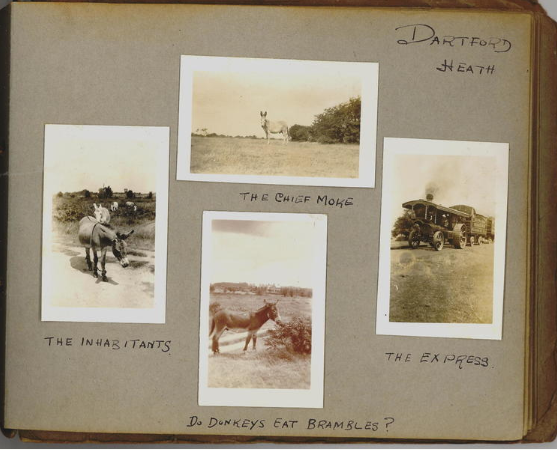
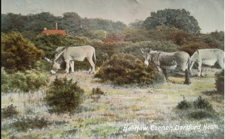
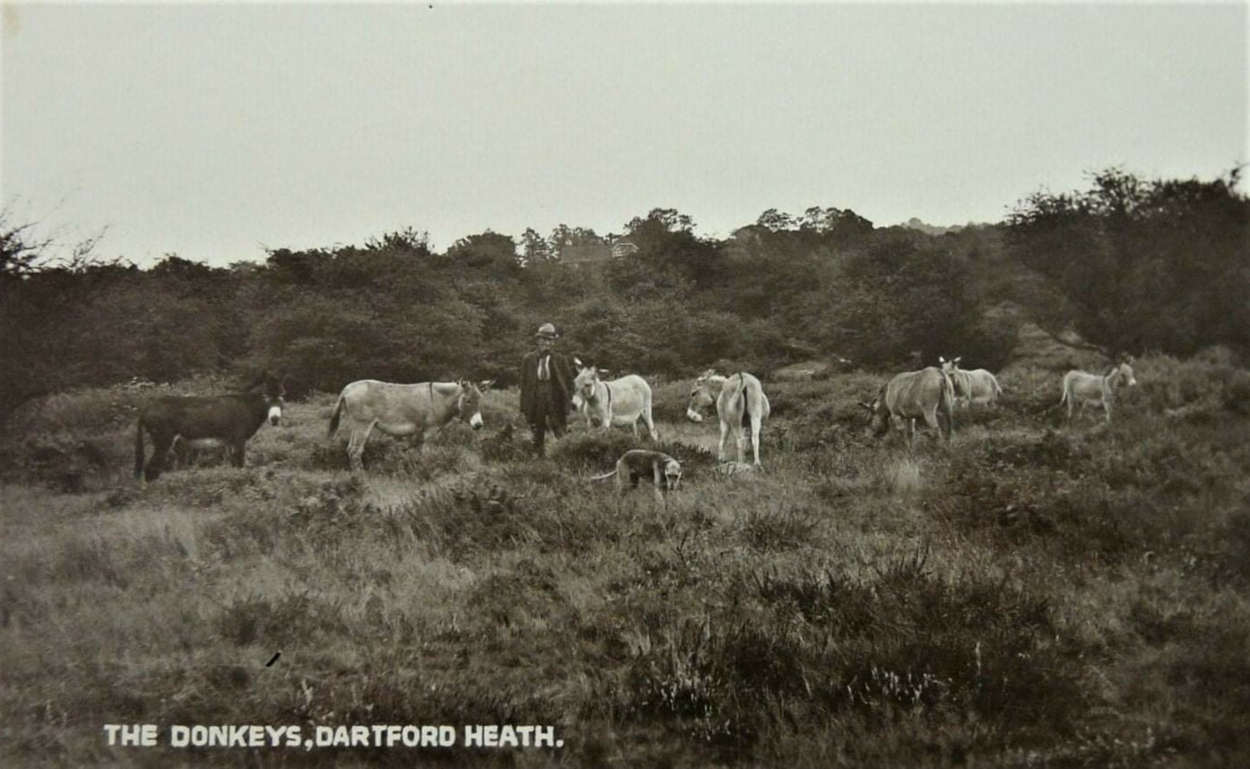
Donkeys on the Heath 1924 - courtesy Audrey Hughes
Below is a red roofed building - quite possibly 'Gravel Pit Cottages'
Below courtesy of Brian Porter - undated
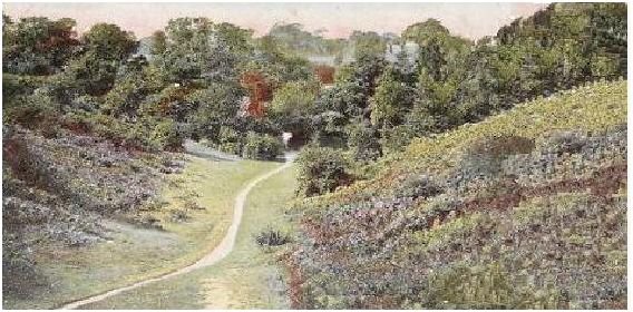
THE DELL
Below - The Dell c1930s path leading up to the road called The Dell
Copyright unknown
![[Untitled]](https://static.s123-cdn-static-c.com/uploads/1523176/2000_5bae42fb11b52.jpg "[Untitled]")
Below - another view c1930s looking towards Coldblow Crescent and the Stile
THE PADDOCK (WOLFE'S GLEN)
Below - Wolfe's Glen. Known by locals as 'The Paddock'. To the right of the photo and over the brow would have been the old A2 and then the Gun Club. To the left would have been the hill towards Heathwood Lodge. Straight ahead would have been in the direction of Hall Place, Bexley. Behind the camerman would be in the direction of Denton Road - near the junction with the old A2.
Below -
Possibly the same view as above c1890 ? But definitely described as Dartford Heath.
(Possibly 'The Dell', towards Coldblow, Bexley ? or 'The Paddock' looking towards the location of the Black Prince)
Below Dartford Heath (Unknown location) by Youens c1892
possibly Rowhill or Bexleyheath in the background.
Below Dartford Heath - Chance Spring Woods by Youens 1893
These woods were just north of Madam Osterbergs College (Now West Kent College, Oakfield Lane)
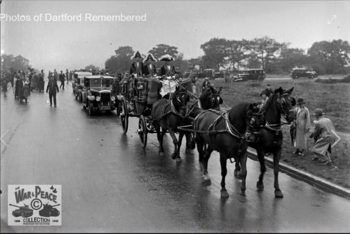
Below - the old Rochester Way on Dartford Heath. Denton Road to the left (towards Maypole Estate) and the road to the right to wards Crayford. Bexley to the rear. Lord Mayor of London's coach and horses Charter Day September 13th 1933 - courtesy of Christine Johnson - Facebook 'Dartford Remembered'
c1940s / early 50s - Tea Stall on the heath - situated on land opposite entrance to the Dell. It was owned and run by Mr and Mrs Houlton from Baldwyns Road, Dartford.
Courtesy of Denny Chandler

